Showing posts with label Sequim. Show all posts

6/11/20

Washington Harbor - 600 Years of Activity

This Washington Harbor shoreline at the entrance to Sequim Bay is one of the most culturally significant and extensively researched historical locations in the Sequim-Dungeness area. The few acres of land shown here were home to a S’Klallam Tribal village for at least 600 years, a clam cannery for more than a half-century, and is now utilized for research in marine sciences.  

Then - Bugge Clam Cannery, approx. 1905-1910 
(Courtesy the Burt Kellogg Collection of the North Olympic Library System)  
Now - Pacific Northwest National Laboratory, May 2020

The historical photo is one of many taken of the Bugge Clam Cannery and available for viewing in the Burt Kellogg Collection of the North Olympic Library System. The cannery operated at Washington Harbor as early as the 1880s and a large Victorian home was built in 1889 (at far right). Sequim pioneer Hans J. Bugge is the most notable developer at the site.  Hans, and later his son Anphin, operated the cannery here for more than 60 years. The cannery had 30-40 employees and at its peak, shipping 10,000 cases of clams per year under the names Moon Kist and Tureen.

Bugge Clam Cannery at Washington Harbor,
with Bugge's Georgian-style home
Courtesy of the North Olympic History Center
The site also included a creamery (1905-1917) and the dock served as the primary port for commercial ships of the Mosquito Fleet until the wharfs at Port Williams and Dungeness were built. Children arrived by boat to a small schoolhouse that also sat on the property until it was moved to a nearby hillside due to winter tidal flooding. In 1910, Hans Bugge replaced the previous home on the site with a 6-bedroom Georgian style home which stood well into the time period of the next owners, Battelle.  

In 1966, Battelle Northwest purchased the property and developed it into a marine research laboratory and continues to operate at the site today as Pacific Northwest National Laboratory, operated by Battelle for the Department of Energy.

The S’Klallam village sxʷčkʷíyəŋ occupied this same site for approximately 600 years, until the late 1880s. The town of Sequim takes its name from this village, which translates to “place for going to shoot,” reflecting the abundant opportunities for hunting. There are a handful of cedar posts on the beach today that remain from that era (far left in the pictures but too small to see). They can be easily spotted from a standup paddleboard or kayak as you paddle along the shoreline.

Cover of Jamestown S'Klallam Tribe's history of the village at Washington Harbor

The most comprehensive and easily accessible telling of the Tribe’s history here was prepared by Jamestown S’Klallam Tribe’s Cultural Resources Specialist David Brownell and is available as an ebook pdf from the Tribal library.   


5/5/20

Port Williams...Bustling Port Now County Park

Port Williams is located on the Olympic Peninsula near Sequim, between Sequim Bay and New Dungeness Lighthouse. It’s currently a Clallam County park with a boat ramp and wonderful beach combing opportunities. But in the late 1800s and into the early 1900s, this spot served as a port for Mosquito Fleet steamers that were providing supplies and transportation to the new settlers of the Sequim prairie. The wharf was built in 1890 and included a hotel, restaurant, post office, store and dance hall. The Port Williams townsite was abandoned in 1922.

Port Williams - Then (early 1900s) and Now (2020)

The historic image is courtesy of the Museum and Arts Center in Sequim-Dungeness. The exact date is unknown, but the ship, the Alice Gertrude, was built in 1898 and ended its run in Clallam Bay, running aground during a snowstorm in 1907.

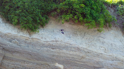
It’s interesting to note the dark stripe that runs horizontally, halfway up the bluff in both photos. This is the result of glacio-lacustrine deposits, sediment that settled in glacial meltwater during the Vashon glaciation period. More than 14,000 years ago, the Cordilleran glacial ice sheet, measuring at least 3000 feet deep, covered most of Western Washington. As it advanced and retreated, the glacier carved much of Puget Sound into the landforms and waterways we see today. It also left us with timeless features to match up in then and now photographs of our ever-eroding bluffs.

Port Williams bluff with two layers of sediment and 2 pigeon guillemots
A better look at the different sediment layers in the bluff, with bonus pigeon guillemots!

There are many other historic photographs of Port Williams to enjoy in the Bert Kellogg Collection, available for viewing on the Washington Rural Heritage digital archive website or in person at the Port Angeles branch of the North Olympic Library System.