I came across this 1940 photo in one of the Magnolia Historical Society's books 'Magnolia Memories'.
What's significant about it is that it's before the sanitation facility was installed in the 1960's.
History Link states "This low sand spit, made by the opposing currents on the sound, was known to the Duwamish Indians by "Per-co-dus-chule," or "Pka-dzEltcua," which translates "thrusts far out." It was known to early mariners as Sandy Point." If you have flash, this is a great history of West Point link.
The shoreline is untouched on the south and north sides and the point aside from the 1881 era lighthouse depicts the other low points with a salt marsh seen elsewhere around the Sound such as Marrowstone Point.
Lighthouse Friends points out that Seattle's raw sewage poured out onto the seemingly pristine beaches making for quite a stink.
The young man in the photo probably didn't know what was coming his way with WW2 starting in the US later the next year.
As a paddle surfer, I like the boat wakes in the lower left image probably by the boat that just passed the point upper right. These days we surf small and freighter size surf along West Point.
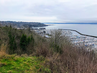
The now image isn't as exciting. Bluff erosion and heavy foliage kept me from being more to the left as the before image depicts. I shot the image in January for better visibility through the trees.
There's a path with a wooden railing leading to the view from the main road.
Google Earth cropped view from (5/26/2018). North -->
Posted by Rob Casey, 1/21


